

Eric Lothmann managed to reduce fertiliser use by an average of 5% this year when growing rapeseed, wheat, barley, and sugar beet. As we speak, the harvest season is just beginning. But when it comes to barley, it is already clear that the crop has not suffered because of reduced inputs, with more even yields and quality seen across the fields. This Rhine farmer owes his success not only to his fertile soil, but also to the site-specific cultivation methods which he started using this year (2022) for the first time.
Working with satellite data-based application maps has already changed Mr Lothmann’s way of thinking: He used to differentiate management according to the field, now he adjusts fertiliser applications within each field based on zones calculated by the Solorrow software from satellite images. Soils on his 400ha arable farm are of high quality and pretty consistent – conditions that initially do not call for site-specific fertilisation. Nevertheless, the farm manager wanted to make fertiliser use even more efficient with the help of satellite technology. In view of the increasingly strict legislation on farm inputs, efficiency has also become an urgent issue. “We need to get the maximum yield from what we are still allowed to use,” explains Mr Lothmann.
Satellite technology is a change that you shouldn’t ignore if you want to lead your operation into the future.
Eric Lothmann
Instead of deciding whether he should fertilise the wheat again based on intuition, satellite data and gross margin calculations now assist in making a rational decision. This is even more important as input costs have risen drastically in recent months. For example, Mr Lothmann increased fertiliser rates in areas with lower, though still very high, yield potential, while reducing rates in the high-yield zones. “I’m impressed with everything that’s now possible. We’ve been working on the digitisation of the farm for 10 years – and the benefits are really becoming clear now.”

Eric Lothmann manages a 400 ha arable farm.
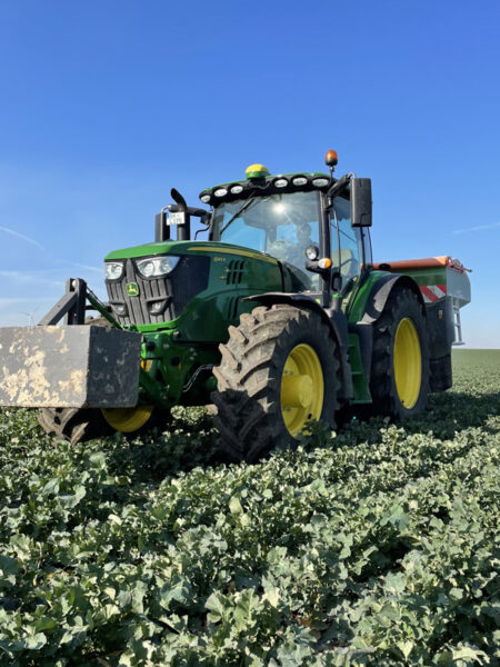
Site-specific mineral fertilizer application on Eric Lothmann's farm.
New opportunities
On the North Sea coast of Lower Saxony, contractor Lars Lange is pursuing a completely different goal when utilising satellite technology: He uses the data from BASF’s xarvio FIELD MANAGER to obtain more uniform maize crops by changing seed rates in variable areas. The contractor Petra Lange has been offering agricultural services in the Cuxhaven hinterland for over 30 years. In 2020, two of his customers suggested that he start using the new technology. This year he tilled 200ha for them using seed application maps. “I was attracted by the challenge of this new technology,” recalls Mr Lange. Thanks to the obtained data, his customers now have a better understanding about their in-field zones.
You shouldn’t be afraid of technology. It’s not always easy to understand, but that’s what makes it interesting.
Lars Lange

Contractor Lars Lange uses xarvio FIELD MANAGER in conjunction with the John Deere Operations Center to create site-specific maize seeding maps.
Other farmers use the data not only to fine-tune their seed and fertiliser applications to soil conditions in the field, but also to apply growth regulators, fungicides, and other crop protection chemicals. Aaron Borcherding, who advises farmers in Sülfeld (Schleswig-Holstein) for the machinery dealer LVD Bernard Krone, finds the latter to be of little use. The reason: The liquid-spray crop protection chemicals fulfil different tasks. When using a Variable Rate of Application (VRA) map for crop protection products, it is important to reconcile the individual agents, contained in the spray mixture, with their respective objectives in the field. The plant protection chemicals should therefore be applied individually.
Nevertheless, the xarvio FIELD MANAGER also considers the mixing ratios in the tank when it comes to crop protection applications. According to BASF field trials with winter wheat (2019-2021), working with xarvio VRA cards saves an average of 15% in fungicide and growth regulator use, while increasing sales by €27/ha (£24).
Technology does not replace people
Satellite images form the basis for creating application maps. Their recordings provide information about the biomass growth in an area. Software like Solorrow, MyDataPlant and xarvio FIELD MANAGER blends the growth data from several years and uses this to calculate the average yield potential of the field, regardless of the crop. As a result, irregular deviations like wildlife damage or fungal diseases cannot affect the overall picture, offering an advantage over sensor technology, which generates data directly in the field which sometimes leads to predicting poorer average yield potential due to a local fungal disease. The satellite maps also score better with complete field coverage. On the other hand, when the skies are cloudy there are sometimes no new images available for weeks, and sometimes cloud shadows lead the algorithms to make incorrect assessments.

Operator terminals in the tractor cab during variable rate maize seeding.

Tractor-planter combination ready for variable rate maize seeding.
Finally, farmers can create field specific VRA maps from the yield potential maps. Based on this input they need to decide on the number of zones as well as the application rates for seeds, fertilisers, crop protection chemicals and growth regulators within these zones. But satellite technology cannot replace the farmer’s experience. It does not interpret the data for them. “You still know your areas better than the system,” emphasises Mr Lothmann.
For the same reason, agricultural contractor Mr Lange works with his customers to determine how the knowledge gained from the data analysis is to be used: Should the less productive zones be seeded more densely or thinly? Depending on the situation, both approaches may be plausible. “Satellite technology only provides the information basis for better exploiting the potential of an area,” he clarifies.

Variable rate maize seeding ...
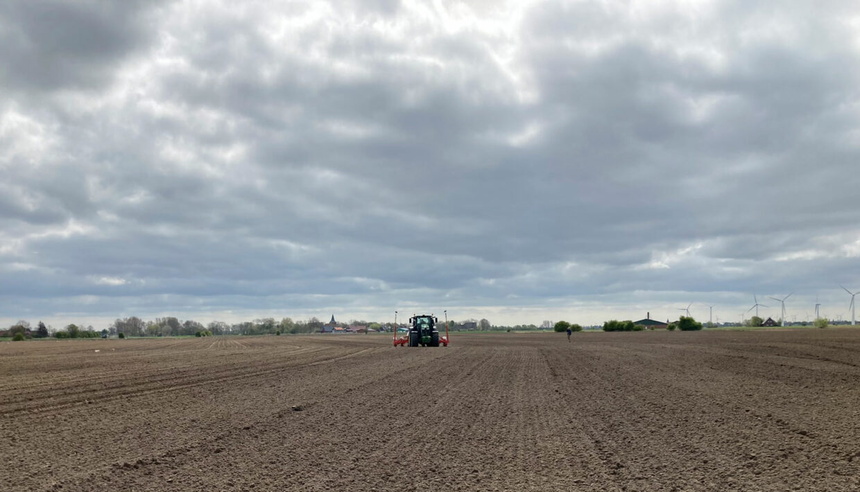
... at a customer of Lars Lange.
Achieve more uniform yields with efficient resource use
When the maps are ready, Messrs Lange and Lothmann check them one last time and then send them directly to the tractor or the MyJohnDeere Operations Centre. Alternatively, the data can be transferred to the terminal using a USB stick. The machine then carries out the instructions independently during the fieldwork, and records the applied quantities at the same time, in order to enable a later target/actual comparison in the software. If the field and settings are well co-ordinated, inputs can be used more efficiently and yields evened out.

Aaron Borcherding advises farmers as a precision farming and AMS specialist for agricultural machinery dealer LVD Bernhard Krone.
This is where precision farming and AMS specialist and part-time farmer Aaron Borcherding sees the greatest potential for satellite technology. He has delved deeply into the technology to advise his customers on precision farming issues. Given the clarity of the web application and the German-speaking customer service with 24/7 telephone support, Mr Borcherding recommends the MyDataPlant software to his customers.
If you cannot handle the new technology, you’re better off with using your gut feeling.
Aaron Borcherding
Many younger customers and larger companies are interested in the new technology. But still, only a few dare to take the first step. Those who do aren’t only looking to keep track of every field with the help of technology, even on very large farms. They’re also hoping to save on resources. Some software providers promise up to 10% more yield with 10% cost savings. Mr Borcherding does not go along with that. “I don’t save on any fertiliser, I simply distribute it more efficiently,” he says with certainty. In the grand scheme of things, it’s not all about further increasing yields in the high-yielding country of Germany, but rather about stabilising yields over the years. Greater planning security and more efficient cost distribution are the true advantages of satellite technology.
At the same time, it should by no means be labelled exclusively as a tool for large-scale farming. Mr Lothmann’s experience shows that it can also be worthwhile for smaller family businesses, although financing here is much more difficult. Therefore, for the past 10 years he has been expanding the technological standard of his machinery fleet, step by step. “Digitisation is a process that you have to grow into, and it requires discipline,” he states. An investment plan helped him to stay on track.
The right software

On his smartphone, Eric Lothmann can directly display the variable fertilizer map for a field.
In principle, anyone who has an ISOBUS and Section Control-capable tractor can start working with satellite technology. The Solorrow software is even an option for farmers who do not have these basic technical requirements and recommends itself with an easy-to-use interface. However, this is not possible without commitment and interest. “If you cannot handle the new technology, you’re better off with using your gut feeling,” emphasises Mr Borcherding.
All programs work with satellite images that are freely available on the internet. The software’s task is to prepare these images in such a way that the information derived from them can be put into practice by the user.
Which software is best depending on individual needs and existing technology. Ultimately, it is also a matter of taste. In addition to Solorrow, MyDataPlant and the Xarvio Field Manager, there are many other programs available. What all these programs have in common, however, is that they are compatible with the John Deere Operations Centre. Paying attention to compatible file formats from the outset can save a lot of frustration. In fact, data formatting errors and errors when setting up the tractor terminals are among the most common problems that Mr Borcherding’s customers face.
Pioneering technology

The display of prescription maps also works on Lars Lange’s tablet.
Despite all the technology and digitisation, the farmer still has to take care of one thing: The decision on how to handle the data. Precision farming is just a support; it makes stock management easier and the crop more homogeneous. Working with technology is demanding and farmers should never rely on it blindly. It does not guarantee that all data is correct, nor can it replace the farmer’s own knowledge.
Compared to other possibilities of precision farming, the satellite-supported application maps offer several advantages: They are relatively inexpensive, cover the entire field, enable more efficient use of operating resources, and reduce error rates in the assessment of yield potential. Mr Lothmann sees technology as a great opportunity for agriculture. “This is a change that you shouldn’t ignore if you want to lead your operation into the future,” he states. His colleague Mr Lange is no less enthusiastic – the feeling of sitting at the machine and seeing that it actually works is phenomenal.
Anyone wanting to get into technology is advised to start small and early, and to not get discouraged if something doesn’t work. At the beginning, working with the satellite data requires a lot of time, discipline and investment into suitable machinery, if such doesn’t already exist. “You don’t go digital with a snap of your fingers,” says Mr Lothmann. However, in view of ever stricter restrictions on fertiliser use and rising input costs, the efforts could soon pay off.
Software solutions at a glance
xarvio FIELD MANAGER
The software can be used to create app and web-based VRA maps for sowing, fertilizing, crop protection and growth control. Xarvio offers a choice of Basic, Pro and Premium packages, with the basic version being generous – free for one year and use on two fields. After that, the subscription is always for just one year and ends automatically. The costs are calculated according to the total surface area and the desired functions.
Xarvio’s yield potential maps are based on satellite images from the past 15 years. A newly developed function automatically integrates distance requirements into the application maps. In addition, the software makes it possible to determine the best time window for fertilization using growth stage models. Of the programs presented here, Xarvio is the only one that also offers site-specific crop protection in the premium version.
MyDataPlant
Like Xarvio, this software from the German provider Kleffmann Digital runs on both mobile devices and computers. Because of the clarity of the web application and the German-speaking customer service with 24/7 telephone support Borcherding recommends MyDataPlant to his customers. The provider lets customers choose from three packages: sowing, fertilization and crop protection (only for the use of growth regulators). When the free 14-day trial for up to five fields has expired, you can take out a subscription for one year, priced according to the number of packages you want and the size of the field.
A special option is the multi-layer tool, which makes it possible to blend data from a wide variety of formats, and incorporate them into the application maps, individually weighted – for example soil samples, drone over-flights or yield data.
Solorrow
Also from Germany comes Solorrow, solely an app, from the provider of the same name which won the Hessian Founder’s Prize 2019 for this program in 2019. Lothmann chose this software because it is easy to use and understand, even for beginners. It’s also inexpensive – the costs are scaled according to the total area. Like the other software providers, Solorrow also offers a trial version: three fields are free of charge. A special feature is the automatic field boundary detection, which saves you from having to actively enter the area data. For farmers without an ISOBUS or Shape-capable tractor, Solorrow offers the driving mode feature. This makes it possible to keep track of the zones and application quantities on a tablet, during actual field work. This also makes it possible to take zone-specific soil samples, and so get to the bottom of the reasons for productivity differences in the field.
For its yield potential maps, the software uses satellite images from the past five years and, if desired, suggests a dosage based on the differences in the field zones. If you so wish, you can also control the dosage manually. As always, the user decides on the application strategy: high application rates in good zones and low rates in bad ones, or vice versa.